Papers
Hydrogeomorphology of the origin of the Amazon River, the
confluence between the Marañón and Ucayali rivers
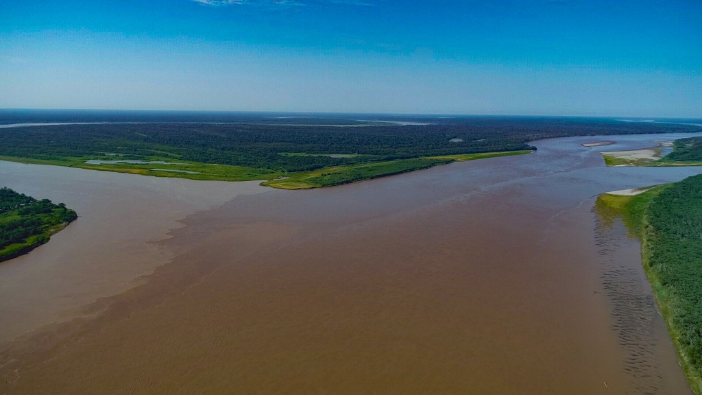
Over geological timescales, the Marañón and Ucayali rivers have shifted extensively along the Ucamara depression. The shifting of these two rivers has defined ancient confluences, however, their morphological characteristics have not been studied. In fact, little is known about the modern confluence between the Marañón and Ucayali rivers, the origin of the Amazon River. This study seeks to describe: the modern and ancient planform dynamism of the Marañón-Ucayali confluence, the processes at the far-field scale that influencing those processes at the near-field scale (near the confluence), and the interaction between meandering and anabranching processes that jointly drive the hydrogeomorphology of the confluence.
Guerrero, L., Abad, J. D., Ortals, C., Valderde, H., Estrada, Y., Chicchon, H., Marin, J., & Canas‐Alva, C. (2024). https://doi.org/10.1002/esp.5949
Hydrogeomorphic characterization of the Huallaga River for the Peruvian Amazon waterway

Several river-related engineering projects lack a broad and comprehensive perspective to understand a river’s spatial and temporal dynamics. One such project is the Amazon Waterway (Hidrovía Amazónica in Spanish), which aims to enhance commercial transport between Brazil and Peru using four rivers: the Amazon, Ucayali, Marañón, and Huallaga. The Terms of Reference (TOR) for the Environmental Impact Study (EIA) did not specify the methodology for understanding river dynamics; instead, the focus was primarily on the need for dredging activities. During the EIA evaluation stage, more than 400 technical observations were presented, many of which were related to fluvial geomorphology. This article synthesizes how proper river studies should be conducted and how river dynamics are related to aquatic biodiversity, emphasizing the importance of understanding rivers before developing infrastructure projects.
Valverde, H., Abad, J. D., Guerrero, L., Estrada, Y., & Frias, C. (2024). https://doi.org/10.1061/JWPED5.WWENG-2021
Hydrogeomorphology of asymmetric meandering channels: Experiments and field evidence.
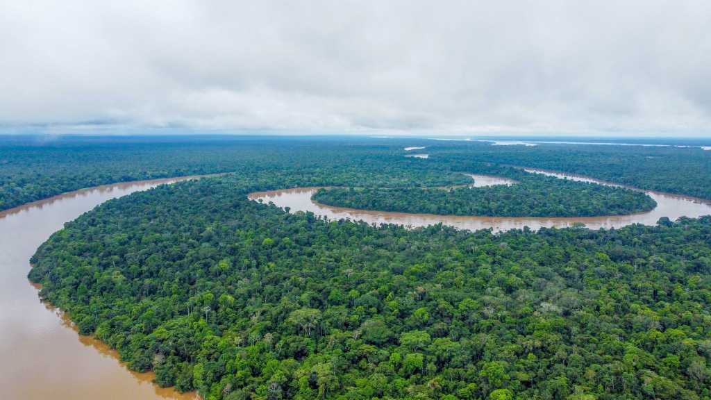
Meandering rivers develop bends that are oriented upstream- and downstream-valley. Laboratory experiments in a meandering channel and field measurements in the Tigre River show that downstream oriented bends produce larger depositional points bars along the inner bank, and more developed secondary flows throughout the bend; therefore, downstream oriented bends migrate at faster rates than upstream oriented bends.
Abad, J. D., Motta, D., Guerrero, L., Paredes, M., Kuroiwa, J. M., & Garcia, M. H. (2023). https://doi.org/10.1029/2022WR033904
Application of HAZUS-MH Flood Model in Developing Countries: The Case of Piura, Peru.
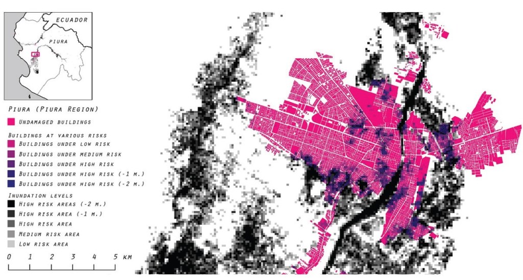
This research looks at the U.S.’s HAZUS-MH Flood Model and adapts some of its methodologies to Piura, Peru, as an example of many regions around the world with limited technical and capital capacity to estimate inundation risks. Thus, this research proposes an accessible and doable flood risk estimation methodology which takes into account limited available data. The proposed methodology will produce maps of potential inundation areas and monetized damage values from flood scenarios. These outputs can further help local authorities design, decide, and prepare their risk mitigation and adaptation plans for the future.
Chantavilasvong, W., & Guerrero, L. (2019). Application of HAZUS-MH Flood Model in Developing Countries: The Case of Piura, Peru. https://doi.org/10.54028/NJ2019163352
